Detailed 3D structural information of the subsurface is fundamental for development of both the hydrological and the geochemical models. The structural information is derived from the geophysical mapping results combined with borehole information. We developed a hydrostratigraphic modelling concept to build a full 3D model of structures combined with structural information on redox conditions, and N-reduction rates. The output of this approach is an ensemble of equally plausible 3D hydrostratigraphic models and redox/N-rates models. The ensemble of models (typically 500) will mimic uncertainties arising from for instance variations in data density (data gaps) and uncertainties related to the translation of geophysical information to structure.
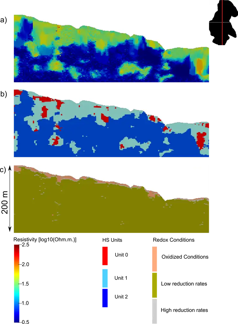
Figure 1. Vertical slices through the 3D model space of: a) geophysical resistivities ; b) Hydrostratigraphical (HS) units; c) Redox conditions. b) and c) shows the result of just one realization in the ensemble of models.
Links to reports:
LOOP2,
LOOP3,
LOOP4,
LOOP6,
Demosites,